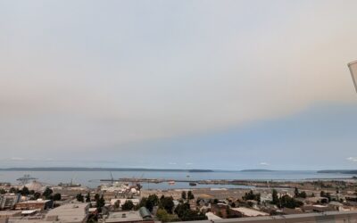
EVERETT — Wild fire smoke spreads over Snohomish County to start the week and will loiter until Thursday when the heat peaks and the wind shifts, according to the National Weather Service in Seattle.
Wildfire smoke is expected to return this week. Smoke likely will be aloft into Monday with hazy skies. Smoke may then reach the ground later Monday-Tuesday. This video shows the total smoke forecast (measure of all smoke in atmosphere). Monitor your air quality agency for info! pic.twitter.com/jmKOiriPsd
— NWS Seattle (@NWSSeattle) August 2, 2026
The latest NWS forecast predicts an upper level ridge will build offshore today and tonight then move inland Tuesday and Wednesday. Thermally induced surface trough developing over the area tonight will remain in place
through at least Wednesday night creating northerly flow in the lower levels. This will pull some smoke over Western Washington. The ridge will shift eastward later Thursday into Friday. Increasing low level onshore flow at the end of the week with cooler temperatures and less smoke.
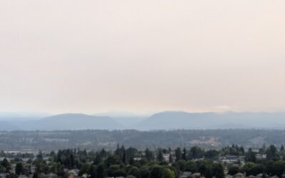
The faint smell of smoke hung in the air across the streets of Evertt this morning as blotches of smoke clung to the peaks and valleys of the Snohomish County Cascades. However, on top of the roof of at the EverettPost.com building on 27th and Colby Avenue, the smell of marine air was obvious from 14 floors up. Tuesday’s increase in expected wildfire smoke accumulating over Snohomish County appears to be much more acute based on satellite imagery from NWS.
Relief won’t arrive until Friday when winds are expected to shift. The Wednesday through Saturday forecast models are showing good consistency for the latter half of the week into the weekend. Upper level ridge axis over the area Wednesday night moving east Thursday and Friday. Thermally induced surface trough moves over the interior Thursday. Afternoon seabreezes developing along the coast cooling high temperatures into the lower to mid 70s. One more hot day over the interior with highs similar to Wednesday, 80s to mid 90s. Moderate HeatRisk with a 20-40 percent chance of major HeatRisk Central and Southern Puget Sound and Cascade foothills.
Increasing low level onshore flow Thursday night into Friday with the ridge axis well to the east and the thermal induced trough moving east of the Cascades. Low level onshore flow will bring cooler temperatures and also push the low level smoke out of the region.