
EVERETT — The city is surrounded by faint smoke from Canadian wildfires creating hazy skies within a 270-degree radius, with the clear exception being southern Whidbey Island. The Snohomish County foothills are more likely to be layered in the thin smoke until tomorrow when a weather pattern shift is expected to force the intruding Canadian smoke into Eastern Washington, according to forecasts.
Everett sits in a unique spot compared to her neighbors north and south as illustrated in the particulate map pictured above from the Washington Smoke Blog, a partnership between state, county, federal agencies, and Tribes.
Both Skagit County and Whatcom County, to the north, are under an air quality alert due to thicker accumulations of Canadian wildfire smoke until 9 a.m. PDT Wednesday. According to the Northwest Clean Air, particulate matter (PM2.5) levels may reach “Unhealthy for Sensitive” groups in those counties. That warning means sensitive groups should take steps to reduce exposure, limit time outside, avoid strenuous outdoor activity, and follow tips for cleaner indoor air.
No warnings have been issued for Snohomish County.
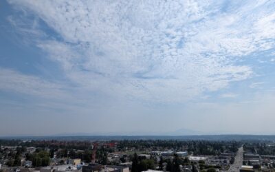
Below is a picture from downtown Everett facing east, northeast and the smoke obscures most of the Cascade Mountain peaks with the exception of Mt. Pilchuck which is faintly visible.
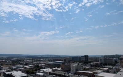
This image facing east, southeast illustrates the thickening smoke slipping past Everett into south Snohomish County. None of the County’s Cascade peaks, like Mt. Index, are visible
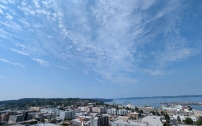
Compare the above images and smoke coverage to this view looking west, southwest toward Mukilteo and southern Whidbey Island from downtown Everett. The blue skies are much bluer and the smoke layer is primarily gathered on the left side of the photo in the Paine Field and Lynnwood direction.
Today at 10:29 a.m. PDT, the National Weather Service issued the following forecast based on the Canadian smoke impacts and the above average high temperatures:
An upper level ridge is centered well to the southeast of the area extending back over Western Washington through Wednesday. A pattern change arrives Wednesday night into Thursday with shower chances increasing and some potential for thunderstorms. An upper level trough moves over Western Washington with low level onshore flow Friday through the first part of next week for a round of seasonable temperatures.
Satellite imagery shows high clouds over most of the area early this morning with patchy low clouds and fog along the coast. High clouds keeping temperatures mild overnight with most places in the lower to mid 60s at 3 a.m.
All this adds up to a pair of hot days for Western Washington with near record breaking high temperatures and maximum low temperatures. Highs today in 80s to mid 90s over the interior warming a couple of degrees Wednesday into the mid 80s to near 100. Highs on the coast in the mid 70s to mid 80s both days. Lows in the lower to mid 60s inland and mid 50s along the coast.
In addition to the heat, northerly flow at times will pull wildfire smoke from British Columbia into Whatcom and Skagit
Counties. Weak easterly flow today will also bring wildfire smoke from eastern Washington west of the crest. While
incoming wildfire smoke may cause localized degradations in air quality at times over the mountains, the smoke is not expected to mix down into the lower levels and is favored to stay east of the Seattle metro.
Changes in the pattern Wednesday night into Thursday with remnants of tropical storm Elida moving through Thursday
morning creating a chance of showers. In addition to the possible showers low level flow turning onshore producing much cooler high temperatures. After lows in the lower to mid 60s again Thursday morning for the interior highs cooling to the 70s and lower 80s. For the coast, lows in the mid 50s and highs in the mid 60s.
The return of low level onshore flow will get rid of any smoke concerns in the lower levels.