
EVERETT – Nearly eleven months ago the Snohomish River was inundated with record flooding and with winter approaching again, the Snohomish County Department of Emergency Management is unveiling more resources to help everybody prepare for natural disasters.
“First, just understand the hazards,” Lucia Schmit, director of Emergency Management, tells the EverettPost.com. To better illustrate the variety of hazards facing Snohomish County, the Dept. of Emergency Management director wants residents to maximize the use of the Snohomish County Hazard Viewer, which can display an address or street location and whether or not it’s located in a dangerous zone for flooding, wildfire or other natural disaster that could benefit from advance preparation.
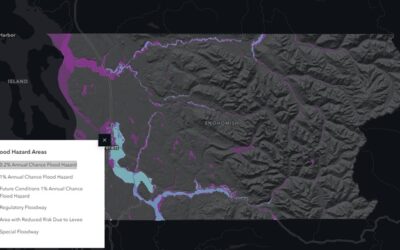
“We hope that people will take the time now before we’re in the midst of a flood to take a look at where our flood plains are within our county,” Schmit implores in an effort to be prepared before the weather gets out of hand.
The Hazard Viewer is now in version 3.0, Schmit tells the EverettPost.com, and its been updated with flood data and coverage from last December’s devastating Snohomish River flooding. The Hazard Viewer is designed to be a prep resource. Type in addresses of key locations you commonly travel to–work, school, family. Find out which of those locations fall within the flood plain or would potentially take you through a flood plain in your regular travels.
You can explore the Hazard Viewer by clicking here.
The Hazard Viewer tabs include categories like “Earthquake hazards”, “Wildfire hazards”, “Severe weather hazards”, “Flood Hazards”, “Dam failure”, “Glacier Peak volcano”, or “Tsunami hazards”. Select a tab and type your address into the query magnifying glass icon in the upper left corner of the viewer to see if that location is in a dangerous area.
The Hazard Viewer allows residents to visualize where the most likely dangers are in proximity to the places they normally live, work, travel or recreate. Its akin to the warning that flight attendants provide passengers at the beginning of airplane flights: the safest exit may be located behind you.
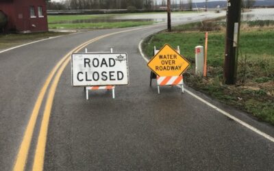
Schmit also advises Snohomish County residents to bookmark the Snohomish County Public Safety Hub on your smart phone browser or computer. Schmit says the Public Safety Hub will always have the fastest updated emergency information in a weather or natural disaster, “to share critical information.”
A third suggestion for proper preparation, Schmit says, is opt-in for SnoCoAlerts. “The other advantage is that it allows you to tie your phone (text alerts) to multiple physical locations. So, you’re not only receiving alerts for the area you happen to physically be in at the time, but you would receive an alert for your home address even if you’re currently at work or vice-versa . You could tie it to your children’s school so you know if there’s something happening in those neighborhoods. It gives you a little bit more flexibility in terms of defining what areas you care about for the messages you’re receiving.”
These are the primary suggestions DEM urges people to incorporate into their flood, winter weather and natural disaster planning, but there are many others which are compiled at this link. Plan accordingly and avoid making a natural disaster worse by planning in advance.